2016 Ecuador Earthquake
Category
Uncategorized
Published on
Sep 03, 2016
Abstract
This dataset was last updated on August 23, 2016.
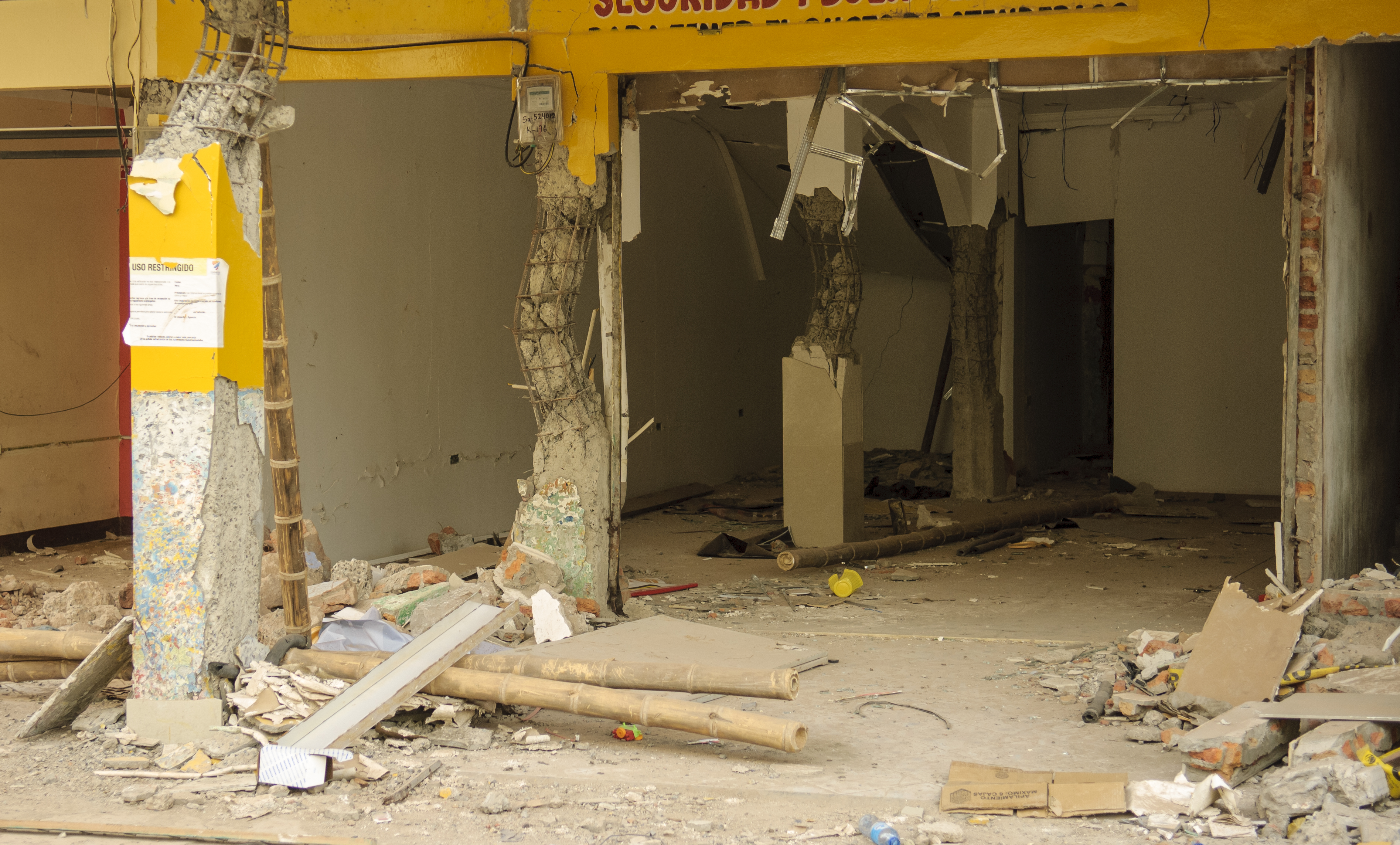
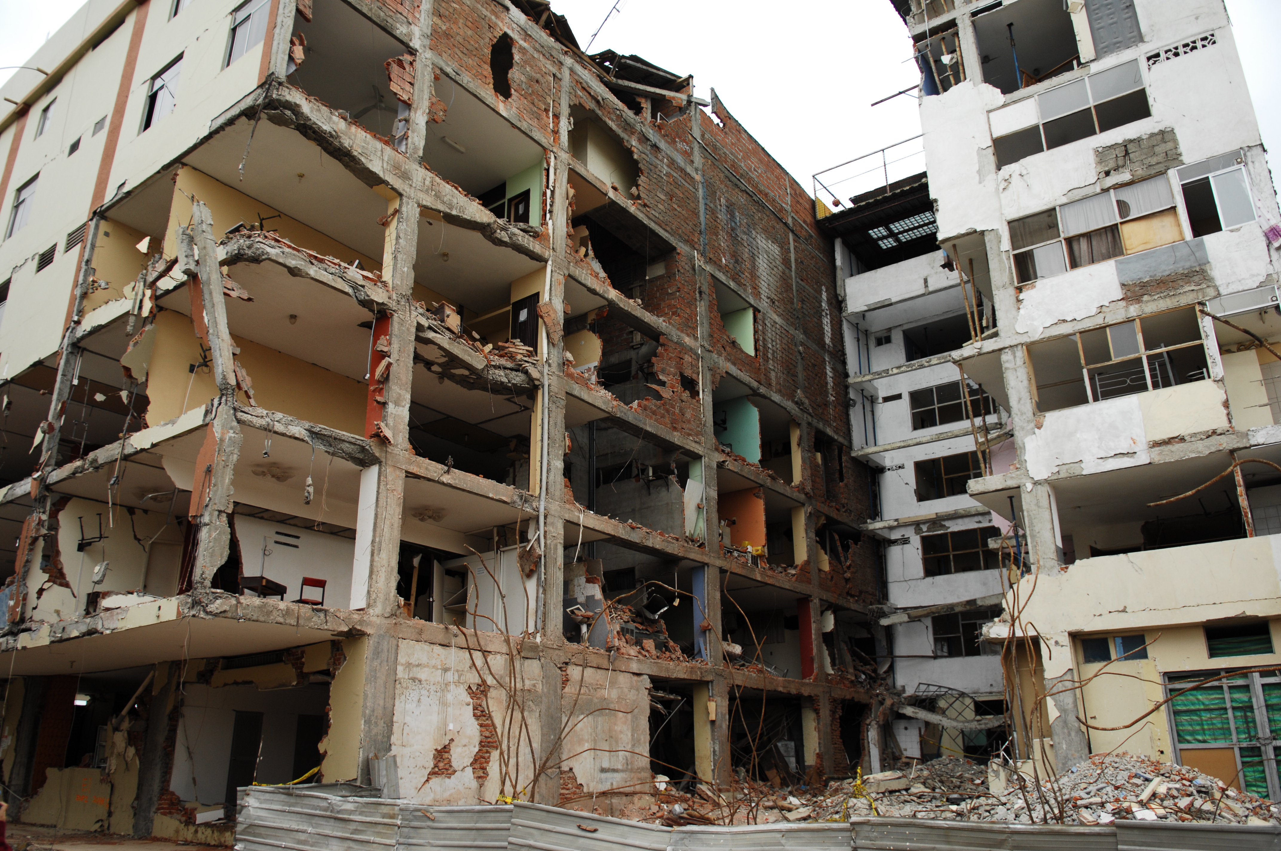
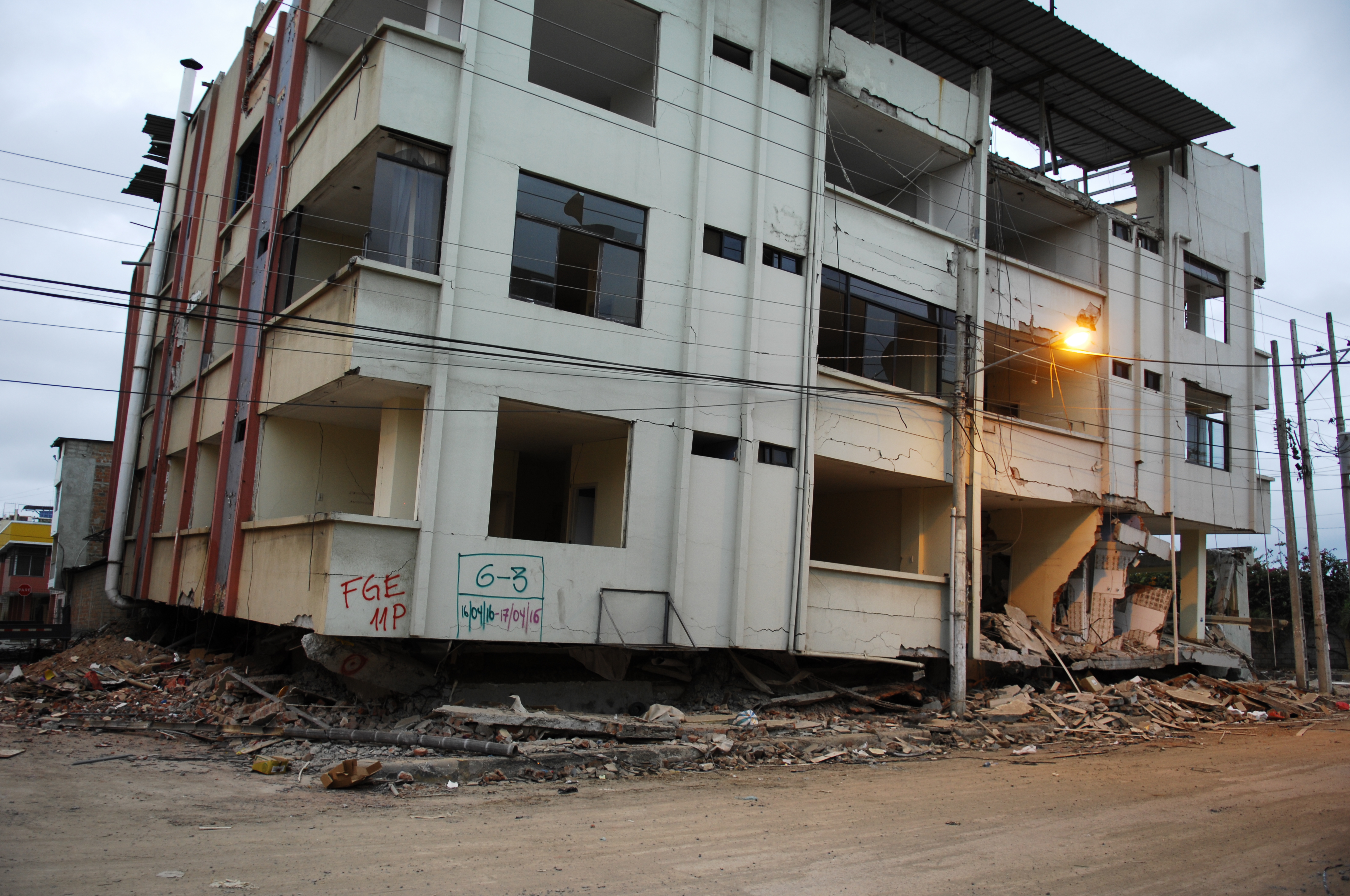
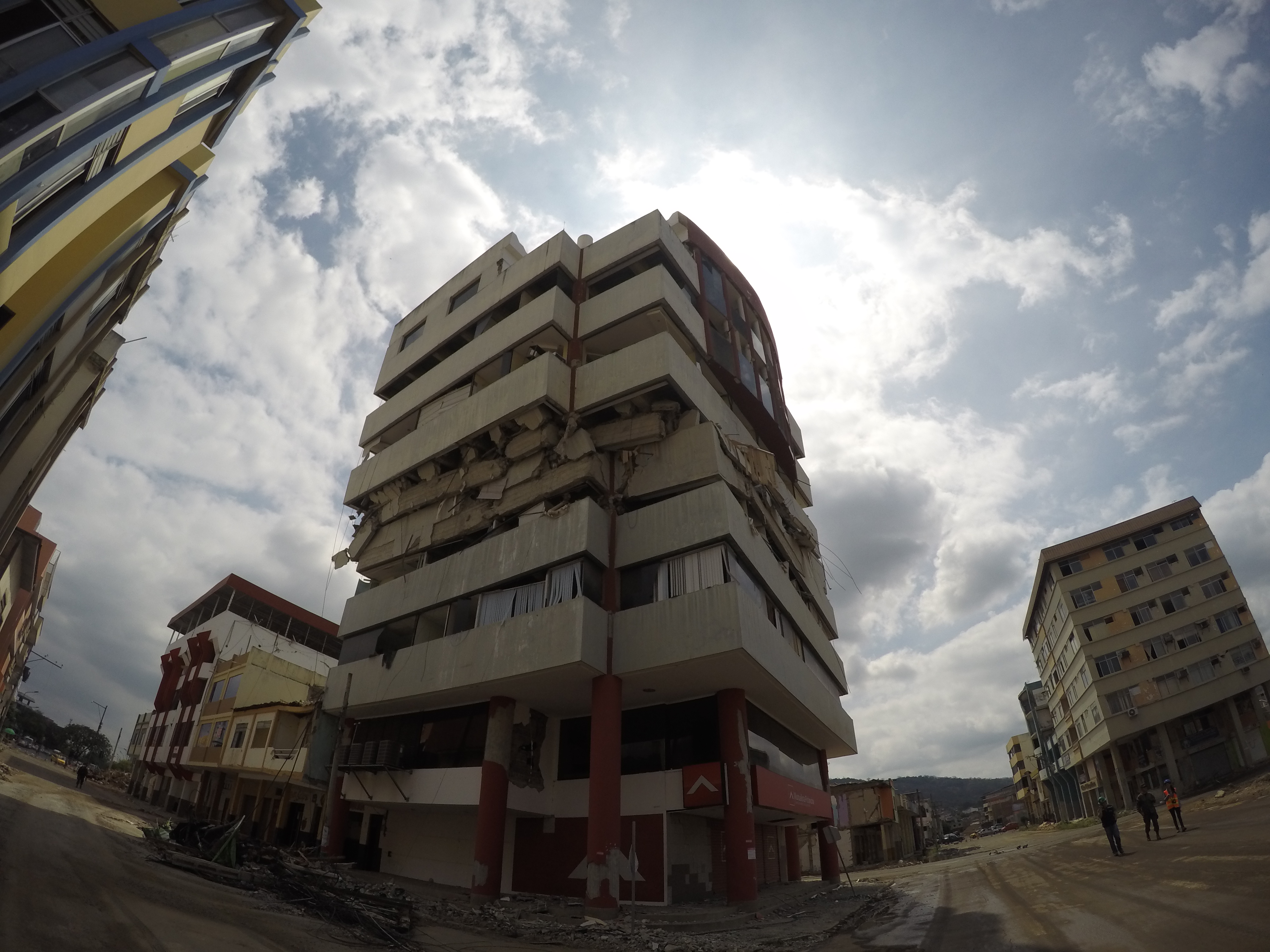
The earthquake in Ecuador occurred on April 16, 2016 with a moment magnitude of 7.8. It caused more than 660 casualties and over 27,730 people were injured. The majority of the human casualties and damage to infrastructure were concentrated in the coastal province of Manabí. As of July 10, more than 2,100 aftershocks had been reported, including 11 aftershocks exceeding a magnitude of 6.0.

Following the April 16, 2016 Ecuador earthquake, a team of researchers supported by the American Concrete Institute traveled to the province of Manabí in Ecuador to document the properties of reinforced concrete buildings affected by the earthquake. The reconnaissance group consisted of 3 teams (A, B, and C) with 3 to 4 people in each team. In Ecuador, the team worked with faculty and students of the Escuela Superior Politécnica del Litoral (ESPOL). The following people from ESPOL are gratefully acknowledged for their help with data collection: Pedro Rojas, Carlos Quishpe, David Lindao, Alixon Ocampo, Marianela Delgado, Reinaldo Salazar, David Valverde, and Jonatan Villavicencio. Without the invaluable support provided by ESPOL, the database created here would not have been possible.


This database is presented as a spreadsheet with each row containing the following information for a building:
- Title: Title of the project, group of experiments, simulations or surveys
- Experiment or Case ID: ID assigned by the source to the sample, specimen, case, survey, site, experiment or simulation
- Keywords: Words describing the dataset
- Report(s): Related documentation
- Parameters: Variables and parameters chosen by the researcher, compiler, professional or scientific organization to describe the data
- Data: Data files generated through project. Tabular text format is preferred
- Photos, Videos, etc.: Media files including photos, videos, audio generated through project
- Drawings/Diagrams: Drawing and diagrams helpful to interpret the data
- Source: Names of the people who generated the data
- Experiment Start Date: Date when experiment started
- Experiment End Date: Date when experiment ended
- Latitude: Latitude of the location where data was collected, if applicable
- Longitude: Longitude of the location where data was collected, if applicable
- Compiled By: Names of the people who compiled the data
- Compiled On: Date when the dataset was compiled
In addition, the following information is presented in the parameter column:
- Title
- Experiment or Case ID
- Latitude
- Longitude
- Priority Index (Hassan Index, %):
PI = WI + CI (where, WI = Wall Index, CI = Column Index) - No. of Floors
- Total Floor Area (m2)
- Column Area (m2)
- Concrete Wall Area (NS) (m2)
- Concrete Wall Area (EW) (m2)
- Masonry Wall Area (NS) (m2)
- Masonry Wall Area (EW) (m2)
- Structural Damage - Three classes of damage
a) Light: Hairline (crack width not exceeding approximate 0.13 mm) inclined and flexural cracks were observed in structural elements.
b) Moderate: Wider cracks or spalling of concrete was observed.
c) Severe: At least one element had a structural failure or at least one floor slab or part of it lost its elevation. - Masonry Wall Damage - Damage to infill walls classified as follows:
a) Light: Hairline cracks occurred.
b) Moderate: Wider cracks appeared or large pieces of plaster flaked off.
c) Severe: The element collapsed or cracks wide enough to see through the wall appeared. - Captive Columns: Are there captive columns?
- Column Index (%)
CI = 0.5 Acol/Af *100%
where,
Acol: the sum of cross-sectional areas of all columns at ground floor.
Af: total floor area above ground level - Wall Index (NS) (%)
WI = (Acw + 0.1Amw)/Af *100%
where,
Acw: the sum of cross-sectional areas of reinforced concrete walls in north-south direction at ground floor
Amw: the sum of cross-sectional areas of infill masonry walls in north-south direction at ground floor - Wall Index (EW) (%)
WI = (Acw + 0.1Amw)/Af *100%
where,
Acw: the sum of cross-sectional areas of reinforced concrete walls in east-west direction at ground floor
Amw: the sum of cross-sectional areas of infill masonry walls in east-west direction at ground floor - Min WI (%)
Minimum Wall Index - Report(s)
- Data
- Photos, Videos, etc.
- Drawings/Diagrams
Cite this work
- Chungwook Sim, Enrique Villalobos, Jhon Paul Smith, Pedro Rojas, Aishwarya Y Puranam, Lucas Laughery, Santiago Pujol (2016), "2016 Ecuador Earthquake," https://datacenterhub.org/deedsdv/publications/view/535.